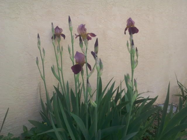

These big irises excite me every year. When I was a kid we had little blue ones, but these are glorious.
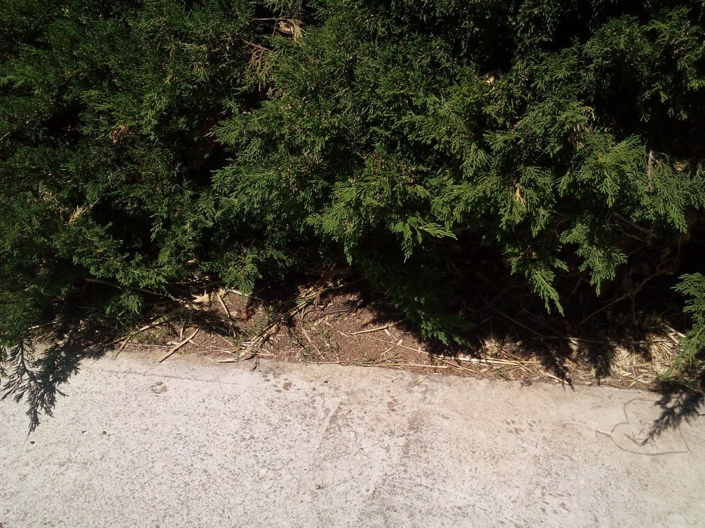
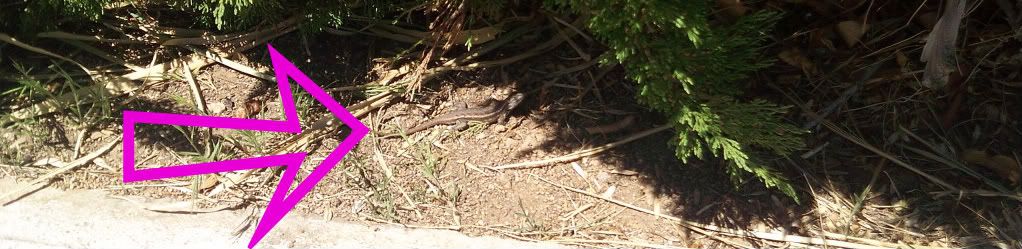
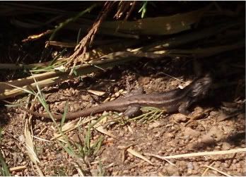
I saw the lizard. Or "a lizard," but as far as I know we have a single lizard in the front yard. Let's pretend, at least.
Can you see him?
Invisibility is their specialty. I was afraid he would run if I leaned closer. I was careful not to cast a shadow on him. He stayed for two more photos, and zipped away before I could do a fourth.
This morning I was asked by e-mail whether little girls in New Mexico did the atomic bomb drills. I wrote this, and figured I might as well put it out where others will know too. My kids, for example.
Yes. "Fallout drills." The fire drill bell was like a classroom bell kind of—electric bell but louder (maybe the same set of bells but on a bigger volume?) The duck and cover drills used another kind of signal—probably the air raid horns left over from WWII. They were a loud hooty honky noise.
One year, or one time, anyway, they marched us to the gym where we sat crosslegged in rows by classroom, and bent over and folded our arms over our heads for a minute or two or whatever.
After that we would sit under our desktops, same position, face down toward our folded legs, arms crossed over our heads.
I think after they saw the damages in Japan, they wanted to protect eyes and faces, and the arms were to protect us from falling.... gym roofs and classroom debris and desks maybe?
Fourth grade is when I really remember it, so maybe it was only that year. It would've been 1962/63 school year.
We were 18 miles** driving on windy roads from Los Alamos National laboratory. I've never looked at a map to see how far that would be without mountains and windy roads, but I'm guessing ten miles. That was the place they were sure would be bombed in New Mexico. That, and maybe Kirtland Airforce Base, and maybe the White Sands Missile Range or Cannon AFB which was down there by White Sands.
Sandra
** OOPS! I had written "hours" and not "miles." I'm really sorry. In those days the road was terrible, from Espanola. First it was a two-lane road paved up and down through every arroyo coming out of Puye and Santa Clara Canyon. Deep dips you couldn't see out of or into as you were driving, so passing was deadly. Then when you finally got to the intersection of the road from Santa Fe to Los Alamos and started going uphill, there was a mile or two where passing was possible. Then came the curves and the climb up the mountainside.
I wish I could remember for sure what the sign used to say, just past Santa Clara Pueblo, but I think it was "Dips next eight miles." Could've been ten or six or twelve. If there had been a jingle, I would remember it. :-)
That drive did NOT take 18 hours, but it could take an hour, or 45 minutes for those who were fearless and not going at rush hour. My dad didn't work there, but lots of people from Espanola worked at the labs, and the labs used to stagger their hours so the road wouldn't be so crowded all at once.
Now the road from the Pueblo to Otowi (no longer really to Otowi, but to an intersection west of there) is four lanes and flat and fast. The road from there up is still two-lane, but there are some passing places, and the curves were much smoothed out in the 1970's. It's faster and safer now.
But going backwards instead of forward, in the 1940's when the labs at Los Alamos first opened, it was a dirt road up a mountainside, and supplies probably did take take two hours from Santa Fe. Maybe more. If someone has a quote on it, please leave a note.
4 comments:
Having lived in Los Alamos and visited Espanola, I'm guessing you meant to say 18 minutes rather than 18 hours.
I'm too young for bomb drills, but I remember the air raid sirens at the Piggly Wiggly in the NE Heights on Sunday morning once a month. That went on until at least the late 70's.
Espanola is pretty close in a straight line, saith Google Earth.
That's a big belly on that lizard. Looks like a little dragon. He must be happy in your yard.
I think those drills sound scary. Speaking of the drastic wartime measures and the things people lived through, I went to that WWII site you linked somewhere, the one with the house tour and blackout curtains. Now I know what those look like. I have yet to try the potato pancakes on that site but I have it printed out hanging by a magnet on my stove hood to do that sometime soon.
Sylvia, no way 18 minutes, but certainly not 18 hours! Thanks. You're right. It was 18 miles. It seemed like hours to me, as a kid, because I got car sick and there were dozens of dips and then a dozen or more mountainside curves. But the feared fallout wasn't going to go by the road.
Thanks, Steve, for looking it up. Living in Albuquerque, I hadn't thought about it much. Maybe Google Earth or Mapquest needs an "as the crow flies" setting. I shudder to think there was probably a map made in 1962 of the distances as the fallout flies.
My mom was in Carlsbad, New Mexico for part of the war, and they had air raid drills, the whole town, and they had blackout and silence requirements. They were having them everywhere, but the stories I know are of Carlsbad.
Post a Comment